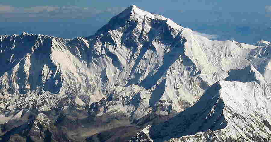
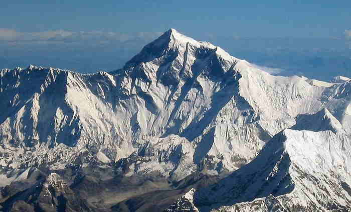
Everest is the highest mountain in the world, standing at a staggering 8,848 meters (29,029 feet) above sea level and located on the border between Tibet and Nepal in the Mahalangur Himalayas. It is part of the Seven Summits, the highest mountains of each of the seven continents, and has been the world's highest peak since the 18th century. The first recorded attempt at climbing Everest was by the British mountaineer George Mallory in 1921. The first successful ascent was achieved by Edmund Hillary and Tenzing Norgay in 1953. Since then, more than 4,000 climbers have attempted to summit Everest and more than 300 have been successful. Everest is considered a technical climb due to its high altitude and the need for specialized equipment such as crampons, ice axes, and oxygen tanks. The routes taken to the summit are typically divided into two categories: the South Col route and the North Col route. The South Col is the most popular and is typically taken by commercial expeditions. The North Col is more difficult and is usually taken by experienced mountaineers.
_887.jpg)
K2 (Mount Godwin Austen), located in the Karakoram Range of the Himalayas, is the world's second-highest mountain peak, standing at 8,611 m (28,251 ft) above sea level. K2 is known as the "Savage Mountain" due to its difficulty of ascent, and the significant risks associated with climbing it. The mountain has seen more than 80 climbing attempts, with around 30 successful summit attempts, making it one of the most difficult mountains to climb in the world. It is also one of the few mountains in the world where no climber has ever successfully reached the summit without supplemental oxygen. K2 is a steep and complex mountain, with extremely steep sections, exposed ridges and unstable seracs. The north face of the mountain is considered by many to be the most difficult and dangerous to ascend. This is due to its steep and exposed terrain, combined with the shifting and unstable nature of the glacial ice that surrounds it. The mountain is often shrouded in clouds, making visibility difficult and posing an additional challenge for climbers.
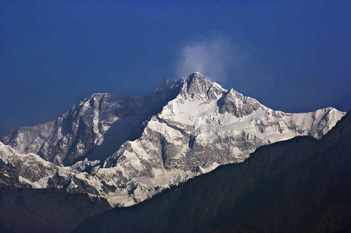
Kangchenjunga is the third highest mountain in the world. It is located in the northern part of Sikkim, India. The peak of Kangchenjunga stands at an impressive 8,586 meters (28,169 feet) above sea level. It is part of the Great Himalaya Range which also includes Mount Everest and K2. The peak of Kangchenjunga is often referred to as “The Five Treasures of Snow” due to the five distinct summits of the mountain. These five peaks, which are arranged in a semi-circle, are known as Kangchenjunga Main (8,586 m), Kangchenjunga West (8,505 m), Kangchenjunga Central (8,482 m), Kangchenjunga South (8,494 m) and Kangchenjunga North (8,474 m). The peak of Kangchenjunga is an important part of the culture and religion of the people in the surrounding areas. The mountain is considered to be sacred by the local people, who believe that it is the abode of the gods. Kangchenjunga is considered to be one of the most challenging and dangerous mountains to climb.
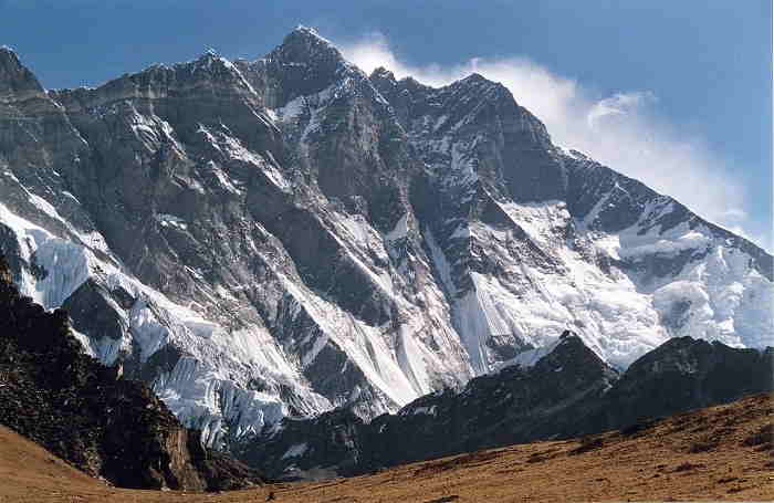
Lhotse is the fourth highest mountain in the world and is situated on the Nepal-Tibet border. It is part of the Mahalangur Himalayas, and is connected to Mount Everest and the adjacent mountain, Nuptse. The summit of Lhotse is 8,516 meters (27,940 feet) above sea level. Lhotse is considered to be a difficult climb due to its steep slopes, technical routes and icy conditions. Many climbers attempt to climb the peak, and the first ascent was made by a Swiss team in 1956. Lhotse is made up of three main summits: Lhotse Shar (8,400 m), Lhotse Middle (8,414 m) and Lhotse Main (8,516 m). The main summit of Lhotse is the highest of the three, and is one of the most difficult climbs in the world. The route to the summit of Lhotse is complex and dangerous. Climbers must first ascend to the South Col of Everest, which is situated at 8,000 meters (26,000 feet). From there, they must traverse a knife-edge ridge to reach the Lhotse Face, a 2,400 meter (7,900 foot) wall of ice and snow. After the ascent of the wall, climbers must ascend the final 200 meters (600 feet) to the summit. The south face of Lhotse is also home to some of the most dangerous and difficult climbing routes in the world, including the infamous "Northeast Couloir" and the "Yellow Band". Although Lhotse has been scaled by many, it remains one of the toughest climbs in the world and is a challenge for even the most experienced climbers.
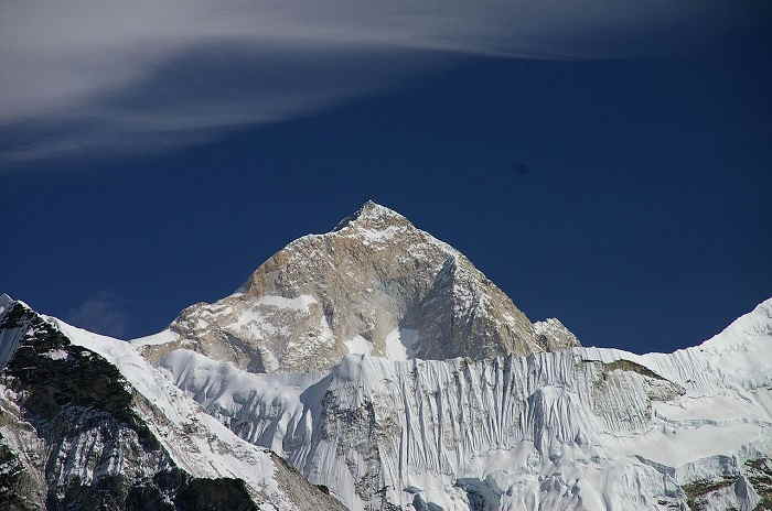
Makalu is an isolated peak located in the Mahalangur Himalaya range of eastern Nepal. It is the fifth highest mountain in the world and stands at 8,481 meters (27,825 feet) above sea level. Makalu has four distinct faces and four ridges, which give it its distinctive pyramid shape. It is an extremely steep mountain, and its south face is a sheer wall of snow and ice. The mountain is surrounded by glaciers and steep valleys. The base of the mountain is located at an elevation of 4,870 meters (15,973 feet) and the summit is 8,485 meters (27,838 feet) above sea level. Makalu is considered to be one of the most difficult mountains to climb in the world due to its steepness and the challenging terrain. The mountain was first climbed in 1955 by a French expedition, and is currently one of the most popular peaks for mountaineers to attempt. The peak is usually climbed from the north side of the mountain, which is the most accessible and the least technical route.
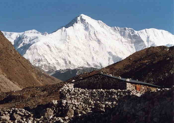
Cho Oyu is an 8,188 metre (26,864 ft) high mountain in the Mahalangur Himalayan range in the Tibet Autonomous Region, China, and the border between Nepal and Tibet. It is the 6th highest peak in the world. Cho Oyu lies in the western part of the Khumbu region of Nepal, just 20 km west of Mount Everest and directly on the border between Nepal and Tibet. It is the most accessible of the 8,000 metre peaks and is the most popular peak for climbers who wish to tackle a Himalayan giant. The summit of Cho Oyu is a broad snow covered plateau, with a wide array of glaciers and crevasses. The main summit ridge runs from west to east, with the Chinese side being more glaciated than the Nepalese side. The peak of Cho Oyu is a popular destination for mountaineers and is easily accessible from the Tibetan side. Routes from the Tibetan side are generally considered to be easier than those from the Nepalese side. Cho Oyu is considered to be a relatively easy 8,000 metre peak to climb and is often used as a training peak for mountaineers aspiring to climb bigger mountains.
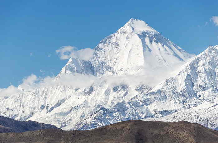
Dhaulagiri is a peak of the Himalayan mountain range located in Nepal, close to the border of India and Tibet. At 8,167 meters (26,795 feet), it stands as the seventh tallest mountain in the world. The mountain is part of the Dhaulagiri Himalayan range and is situated between the Kali Gandaki Gorge on the west and the Myagdi Khola on the east. Dhaulagiri was first surveyed in 1808 by a team of British surveyors, who named it "Dhaulagiri" which means "white mountain" in Sanskrit. The mountain is sometimes called the "Mountain of the Thunders" due to its frequent thunder and lightning storms. Dhaulagiri is known for its steep slopes, which require mountaineers to use the techniques of rock climbing and ice climbing. The south face of the mountain is particularly steep and requires mountaineers to use crampons and ice axes for a safe ascent. The first successful ascent of Dhaulagiri was made by a Swiss-Austrian expedition led by Max Eiselin in 1960. Despite its height, Dhaulagiri remains relatively unknown and is considered to be a fairly inaccessible mountain due to its steep slopes and bad weather conditions.
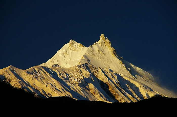
Manaslu is an 8,163 meter (26,781 ft) peak in the Himalayan mountain range located in the Gorkha District of Nepal. The name Manaslu is derived from the Sanskrit word “Manasa” meaning “intellect” or “soul”. It is the 8th highest peak in the world and is part of the larger Manaslu Conservation Area, a protected area of over 1,663 square kilometers of land that is accessible by foot or by helicopter. The Manaslu peak is known for its challenging terrain, with challenging snow and ice conditions, and high-altitude avalanche risk. The peak is located in a remote area, with access points typically requiring a long trek from the nearest road. The climbing season generally runs from April to May or September to October, when weather conditions are more favorable. The Manaslu peak has a steep and rocky east face, a dramatic south face with a large hanging glacier, and a gentle sloping west face with ridges and glacier-filled valleys. The summit is flanked by five ridges, with the south ridge being the most difficult to climb. The summit is also surrounded by several large glaciers, including the Langtang and the Annapurna. Manaslu is considered one of the most dangerous 8000 meter peaks to climb due to its technical difficulty, unpredictable weather, and high altitude.
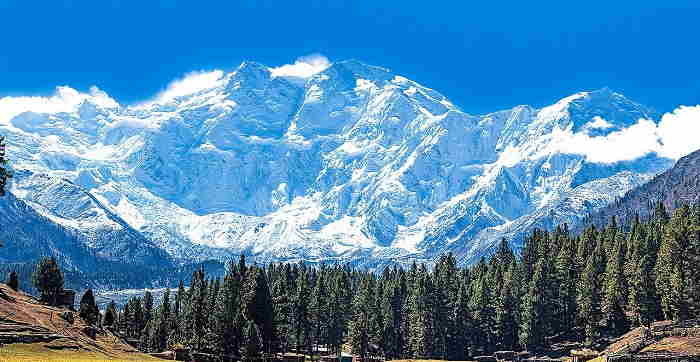
Nanga Parbat is the ninth highest mountain in the world. It is situated in the Gilgit-Baltistan region. With a summit elevation of 8,126 meters (26,660 ft), it is the western anchor of the Himalayas. Nanga Parbat is sometimes referred to as the "Killer Mountain" because of its difficult terrain and the many mountaineers that have lost their lives trying to summit it. The first successful ascent of Nanga Parbat was made in 1953 by an Austrian-German expedition led by Hermann Buhl. Its name is derived from the Sanskrit words nagna ("naked") and parvata ("mountain"), meaning "naked mountain". Nanga Parbat is part of the Himalayan mountain range. It is one of the highest and most challenging peaks in the world, and it is a popular destination for mountaineers and adventurers.
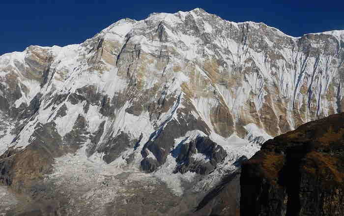
Annapurna is a mountain range located in the Himalayas in northern Nepal, stretching from the Kali Gandaki Gorge in the west to the Marshyangdi River in the east. It iis the tenth highest mountain in the world and has many of the world's highest peaks, including Annapurna I (8,091 meters), Annapurna II (7,937 meters), Annapurna III (7,555 meters), Annapurna IV (7,525 meters), and Annapurna South (7,219 meters). The Annapurna range is one of the most popular trekking destinations in the Himalayas and is the location of the world's most dangerous mountaineering route, the Annapurna Circuit. The Annapurna range is composed of several distinct peaks, each of which offers a unique and challenging mountaineering experience. Annapurna I is the highest peak in the range, and is known as a difficult climb due to its steep slopes, icy conditions, and unpredictable weather. Annapurna II is a bit easier to climb and offers stunning views of the surrounding landscape. Annapurna III is commonly used as a base camp for further exploration of the range, and Annapurna IV is an excellent peak for mountaineering beginners. Annapurna South is a much smaller peak, but is still a challenging climb due to its steep incline and difficult terrain.