
New Guinea, the world's second-largest island and the largest island in the Pacific Ocean, is a captivating landmass situated in the southwestern Pacific Ocean. The island is politically divided into two regions: the western part, known as Western New Guinea or West Papua, is governed by Indonesia, while the eastern part comprises the independent country of Papua New Guinea. New Guinea has an area of 785,753 square km.
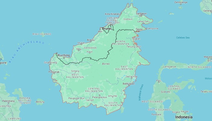
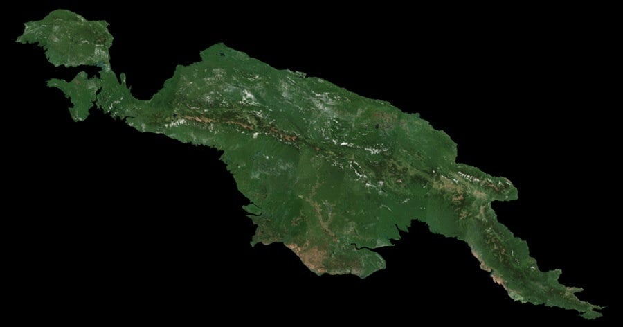
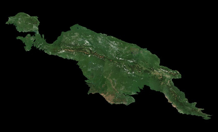
Borneo, the third-largest island in the world, is a vast and ecologically diverse landmass located in Southeast Asia. Shared by three countries—Indonesia, Malaysia, and Brunei—it is situated at the geographic center of Maritime Southeast Asia. The island spans approximately 748,168 square km, making it larger than France and placing it among the world's most significant islands. Borneo's strategic location straddles the equator, contributing to its tropical climate and lush landscapes. The island is characterized by dense rainforests, mountain ranges, and extensive river systems.
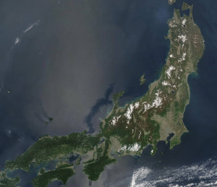
Honshu is the largest and most populous island ilocated in the archipelago of Japan. It is the seventh largest island in the world, with an area of over 227,000 square kilometers. The island is divided into five regions, including the Tohoku, Kanto, Chubu, Kansai, and Chugoku areas. Honshu is the northernmost of the four main islands of Japan and is home to the country’s capital, Tokyo. The island is known for its mountainous terrain and its many volcanoes, including the active Mount Fuji. The highest peak on the island is the 3,776-meter Mount Iwate.
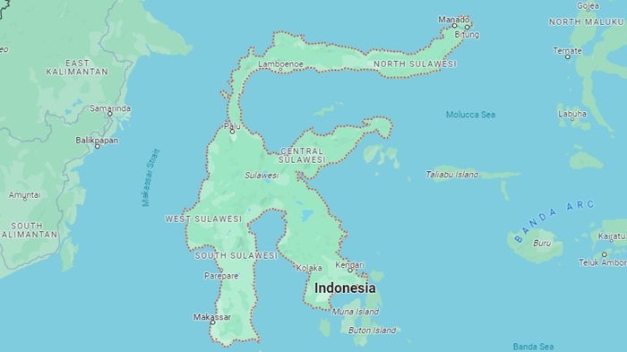
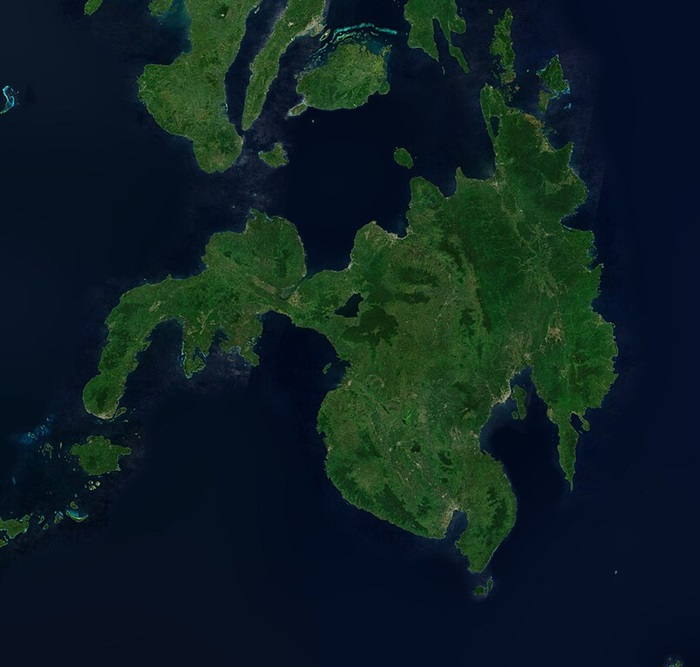
Sulawesi is an island situated in the Pacific Ocean, located between the Indonesian islands of Borneo to the west and the Maluku Islands to the east. It has an area of 174,600 square km. Sulawesi is divided into four provinces: Gorontalo, West Sulawesi, South Sulawesi, and North Sulawesi. The island is surrounded by the Celebes Sea to the north, Makassar Strait to the east, the Flores Sea to the south, and the Bali Sea and Molucca Sea to the west. The island of Sulawesi is home to a wide range of ecosystems, including tropical rainforest, mangrove forests, and coral reefs.
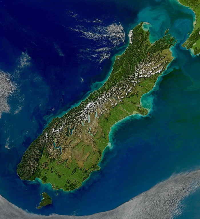
The South Island is the largest of New Zealand’s two main islands, covering an area of 150,437 square km. It is located to the south-east of the North Island and is separated from it by the Cook Strait. The South Island is the largest landmass in the country and accounts for about one-third of its total area. The South Island is home to the Southern Alps, a mountain range that runs the length of the island, separating the eastern and western coasts. This range includes Aoraki/Mount Cook, the highest peak in the country at 3,724 metres (12,218 ft).
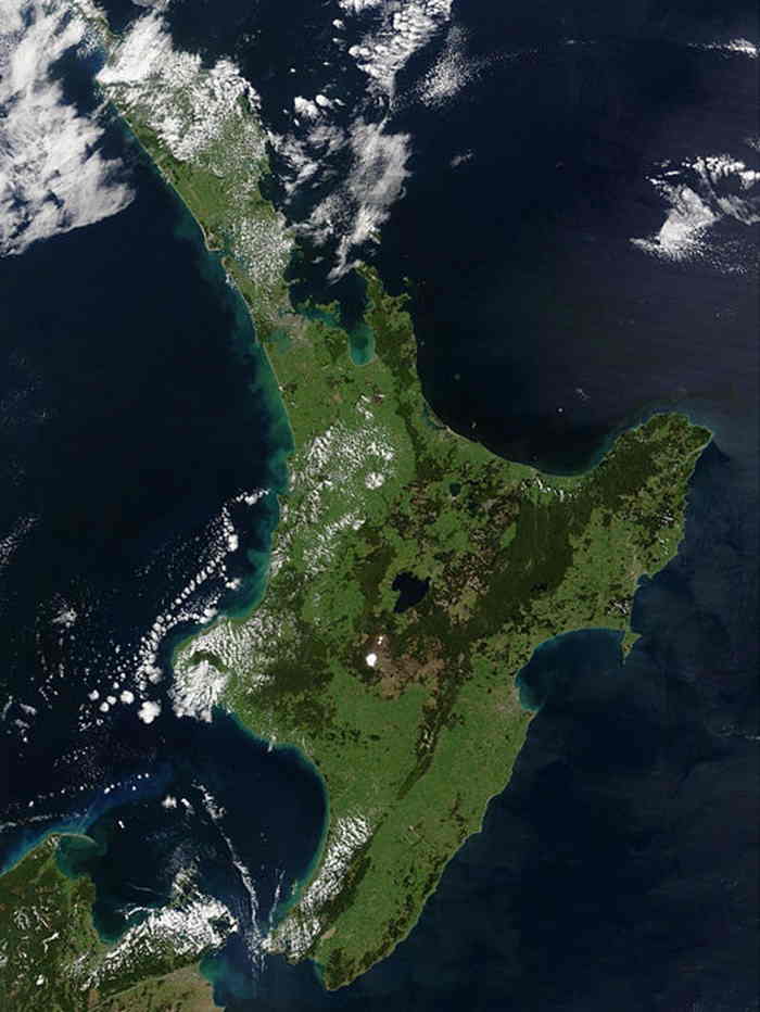
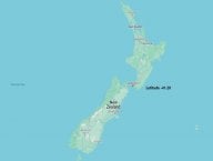
North Island is one of the two main islands of New Zealand, located in the southwestern Pacific Ocean. It has an area of 113729 square kilometers. North Island is situated at the northern end of the South Pacific Plate, making it the most northerly of the islands in the Pacific. It lies north of the Cook Islands, Tonga, and Samoa, east of Australia, and south of the equator. The island is characterized by a diverse landscape, with rolling hills, mountains, and an extensive coastline. North Island is an important economic center for the region, with its major cities of Auckland, Wellington, and Hamilton being home to a variety of businesses and industries.
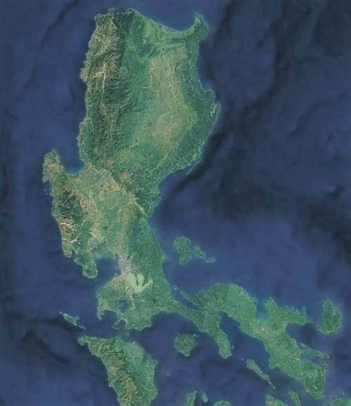
Luzon is the largest island in the Philippines. It is located in the western Pacific Ocean and is bordered by the South China Sea to the west, the Philippine Sea to the east and the Celebes Sea to the south. The island has an area of 109,965 square km. Luzon is divided into four regions: the northern region, the central region, the southern region and the Cordillera region. The northern region is composed of Ilocos Norte, Ilocos Sur, La Union, Pangasinan and Cagayan. This region is known for its historical sites and cultural attractions.
Mindanao is the second largest island in the Philippines, located in the southwestern part of the archipelago. The island is part of the larger island group known as the Visayas, which is located in the western Pacific Ocean. Mindanao has an area of 104,530 square km. Mindanao is a mountainous, rugged island, bordered by the Bohol Sea to the north, the Sulu Sea to the west, and the Celebes Sea to the south. The island is home to several mountain ranges, including the Zamboanga Peninsula, the Bukidnon Highlands, and the Caraga Range.
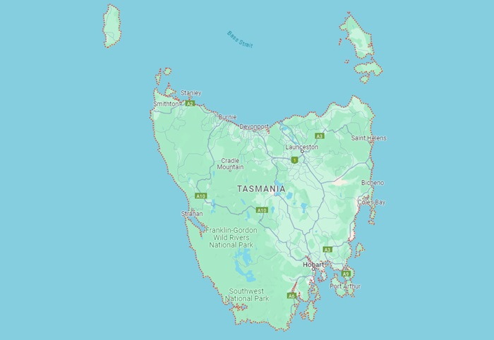
Tasmania is an Australian island located in the Pacific Ocean, situated approximately 240 kilometres south of the mainland. It is Australia’s only island state. The island spans a total area of 90,758 square km. Tasmania is the least populated state in Australia. The majority of the population is concentrated in the capital city of Hobart, which is located on the south-eastern coast of the island. Tasmania is a very diverse place and is home to many different climates and landscapes. The north and west coasts of the island are much cooler and wetter than the south and east, which are much drier and warmer. The mountainous regions of the island are covered in snow during winter, while the coastal areas experience mild temperatures year-round.
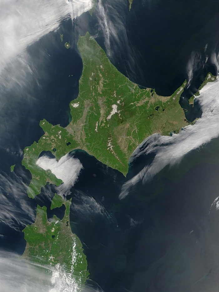
Hokkaido is the second largest island in Japan and the northernmost of the country’s four main islands. Located in the Pacific Ocean, it is part of the archipelago of Japan, and is located to the north of the other three main islands, Honshu, Shikoku and Kyushu. Hokkaido covers an area of over 77,981 square km. It is bordered to the south by the Sea of Japan and the Sea of Okhotsk to the east.
_491.jpg)


_362.jpg)