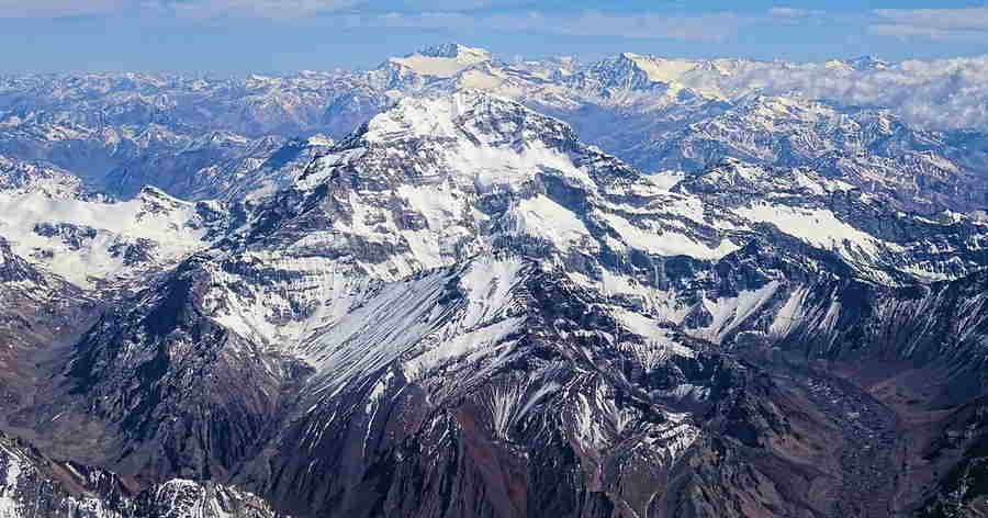
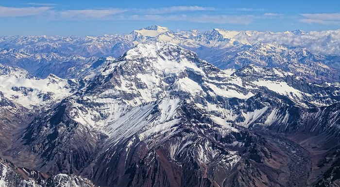
Aconcagua is a mountain in the Andes mountain range, located in the Mendoza Province of Argentina. At an elevation of 6,961 meters (22,841 feet), it is the highest peak in the Southern and Western Hemispheres, and the highest point in the Americas. It is also the highest peak outside of the Himalayas. Aconcagua is a part of the Aconcagua Provincial Park, which is located in the border region between Chile and Argentina. The mountain is located in the Andes mountain range, part of the great chain of mountains that stretches along the western coast of South America. The mountain has a long and rich history. It was first climbed by Edward Whymper in 1897, and since then has been climbed thousands of times. In terms of its height, Aconcagua is the highest peak in the Americas, and the second highest peak in the world outside of the Himalayas. The summit is often referred to as “the roof of the Americas”, due to its immense height. Aconcagua is composed of several distinct geological formations. The mountain is made up of several distinct rock layers, primarily composed of sedimentary rocks, limestone, sandstone, and conglomerate. The summit is composed of igneous rocks, such as granite and quartzite. The mountain also contains a large amount of glacial ice, with numerous glaciers flowing down its slopes. Aconcagua is considered one of the Seven Summits, a list of the highest mountains on each of the seven continents.
Ojos del Salado is an active volcano located in the Andes Mountains on the border of Argentina and Chile. It is the highest volcano in the world, standing at an impressive 6,893 meters (22,615 feet) above sea level. The name Ojos del Salado translates to "Eyes of Salt" in Spanish, referring to the nearby salt flats. The volcano is a popular destination for mountaineers and hikers looking for a challenging climb. The ascent to the summit is relatively straightforward, but it can be extremely difficult due to the high altitude. The terrain is often covered in snow and ice, making it especially difficult to navigate. The summit of the volcano is marked by a large crater, which is popularly believed to be the origin of the mountain. The peak of Ojos del Salado is the highest point on the border between Argentina and Chile, and it is one of the few border points that can be seen from both countries. Ojos del Salado is surrounded by a variety of landscapes, from desert to steppe to glaciers. The volcano is a popular place for stargazing, as it is far from light pollution and has clear skies. The views from the summit are spectacular, offering panoramic views of the surrounding mountain ranges and the desert.
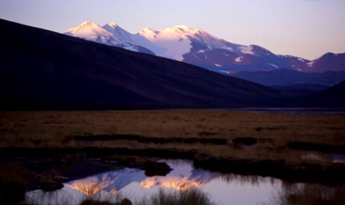
Monte Pissis is located in the province of San Juan, Argentina. It stands at an impressive 6,792 meters (22.283 feet) above sea level. Monte Pissis is part of the Andes mountain range and is located near the border between Chile and Argentina. It is a stratovolcano, with a large crater at its summit, that last erupted in 1877. It is part of the Los Andes National Park, which protects a number of glaciers, lakes and valleys. The mountain is recognized for its treacherous terrain, making it a challenge for even the most experienced mountaineers. The summit is covered in snow and ice, with strong winds and extreme temperatures. The climb to the summit is considered one of the toughest in the world, and can take up to seven days to complete. The mountain has a long history of being a challenge for mountaineers, with many attempting to reach its peak since the early 19th century. The first successful ascent was in 1937, by the mountaineers Cesare Maestri and Juan Enrique Ayarza.
Huascarán, Peru is an incredible mountain located in the Cordillera Blanca mountain range of the Peruvian Andes. It is the tallest mountain in Peru, standing at an impressive 6,768 meters (22,205 feet) above sea level. The mountain is located in the province of Ancash, in the northern region of the country. The mountain is part of the Huascarán National Park, an area of protected land that was designated a UNESCO World Heritage Site in 1985. The park is home to a variety of flora and fauna, including the spectacled bear, the puma, the Andean condor, and the alpaca. The area is also known for its incredible glaciers, which can be seen from the summit. The Huascarán is a popular destination for mountaineers and trekkers, who come from all over the world to experience the challenge of climbing the mountain. The summit can be reached via a number of routes, but the most popular is the Santa Cruz Valley route. This route is a three-day trek, with a steep climb to the summit.
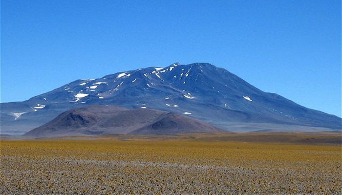
Cerro Bonete is a mountain located in the Northern Patagonian Andes of Argentina. It is the highest peak in the region, standing at an impressive 6,759 meters (22,175 feet) above sea level. Its steep slopes and rocky terrain make it a challenging climb for avid adventurers and mountaineers. The mountain is situated in the Los Andes region of northwestern Argentina and is part of the Aconcagua mountain range. Its summit is visible from the nearby city of Mendoza and can be seen silhouetted against the sky on clear days. Cerro Bonete has a long and fascinating history. It was first conquered in 1895 by the French explorer, Paul Gussfeldt. Since then, it has been the destination of many mountaineers and adventurers seeking to challenge their skills and stamina. The first successful ascent of the peak was made in 1957 by the Italian mountaineer, Achille Compagnoni. The mountain is known for its unpredictable weather and can often be shrouded in clouds, making it difficult to reach the summit. Despite these conditions, it is still considered a popular destination for experienced climbers.
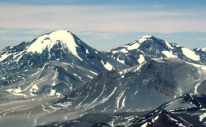
Nevado Tres Cruces is a prominent mountain massif located in the Andes mountain range, spanning the borders of Chile and Argentina. Its name translates to "Three Crosses Snowy Peak" in English. The massif consists of three main peaks: Tres Cruces Sur, Tres Cruces Central, and Tres Cruces Norte, with Tres Cruces Sur being the highest at approximately 6,748 meters (22,142 feet) above sea level. This majestic mountain is part of the Nevado Tres Cruces National Park in Chile and offers breathtaking views of high-altitude landscapes, including glaciers, alpine lakes, and rugged terrain. The park is known for its diverse flora and fauna, adapted to the harsh conditions of the Andean highlands.
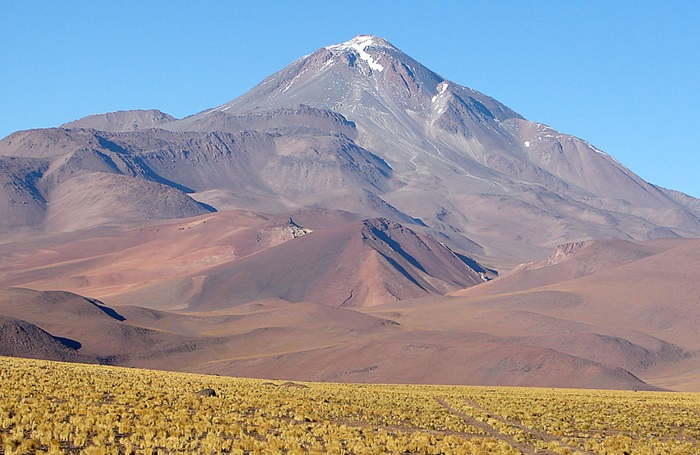
Llullaillaco is a dormant stratovolcano located on the border of northern Argentina and Chile and is one of the highest volcanoes in the world. It is part of the Andes and is located in the Los Andes mountain system. Llullaillaco stands at an impressive 6,739 meters (22,109 feet) above sea level, making it the second highest volcano in the world, second only to the Chilean volcano Ojos del Salado. The summit of Llullaillaco has two main craters and a number of smaller craters. The lower crater, known as the Llullaillaco Crater, is the most active and has been the source of several lava flows over the past few decades. The area around Llullaillaco is home to a variety of unique and interesting wildlife, including llamas, vicuñas and other animals. The mountain is also host to a variety of plants, and even a few species of trees. The volcano is also notable for its archaeological significance. In 1999, the mummies of three Inca children were discovered near the summit of Llullaillaco, along with a variety of artifacts. These mummies, known as the Llullaillaco Mummies, are the best-preserved mummies ever found and are considered to be some of the most important archaeological discoveries of the 20th century.
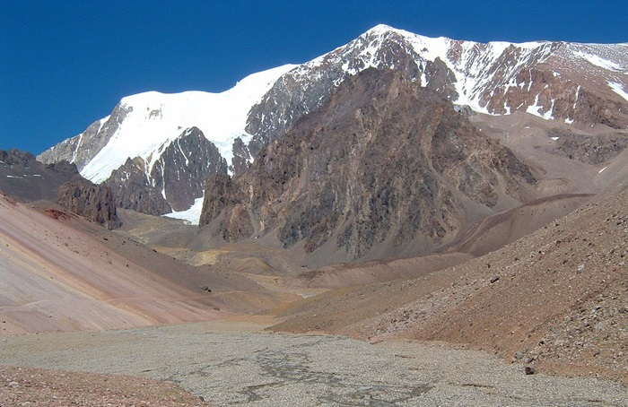
Mercedario is a mountain located in the Argentine Andes, in the province of Mendoza. It has a height of 6,720 meters (22,050 feet). The mountain is located in the Central Andes, in the western part of the province, close to the Chilean border. The mountain is part of the Cordón del Plata mountain range, which is one of the most prominent ranges in the Andes. Mercedario is considered one of the more challenging peaks to climb in the world due to its height and the steepness of its slopes. It is often said that the mountain is best climbed from the Chile side of the border, but there are also routes from the Argentine side. The route from the Chilean side is considered easier, as it is mostly snow-covered, while the Argentine side is more rocky and technical. The ascent to the summit of Mercedario is long and strenuous, often taking over a week to complete. The views from the summit of Mercedario are truly breathtaking. Due to its height and the surrounding landscape, Mercedario is an excellent spot for ski mountaineering and paragliding. Mercedario is often referred to as the "Giant of the Andes" and is a popular destination for mountaineers from all over the world.
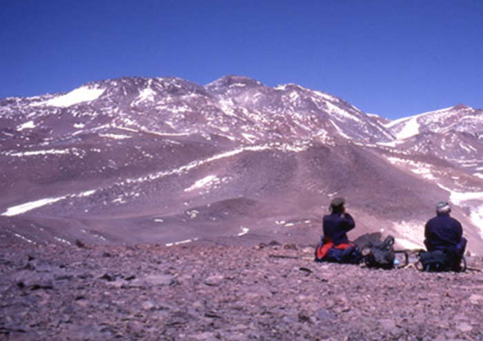
Cerro Walther Penck, commonly known as Cerro Tipas, is a prominent mountain located in the Andes mountain range in South America, straddling the border between Argentina and Chile. Standing at an elevation of approximately 6,670 meters (21,880 feet) above sea level, it is one of the high peaks in the region and is renowned for its challenging climbing conditions. The mountain is named after the German geologist and geomorphologist Walther Penck, recognized for his contributions to the understanding of glacial landforms. Cerro Tipas is part of the Puna de Atacama, a high plateau characterized by vast, arid landscapes and unique flora and fauna adapted to extreme altitudes. Climbers and mountaineers are drawn to Cerro Walther Penck for its remote and pristine environment, as well as the technical challenges it presents. The ascent typically involves navigating glaciers, crevasses, and challenging rock formations, making it a demanding expedition that requires advanced mountaineering skills.
Incahuasi is a mountain located in the Andes mountain range, between Argentina and Chile. It has a peak elevation of 6,621 meters (21,722 feet) above sea level. The mountain is situated on the border between Argentina and Chile, just a few kilometers from the Chilean city of San Juan and the Argentine city of Mendoza. The mountain is part of the Andes mountain range and is composed of sedimentary rocks and lava flows, with the highest peak being a volcanic cone. The mountain is composed of mostly igneous and metamorphic rocks, which give it its distinctive appearance. Incahuasi is a popular destination for mountaineers and hikers, as it offers spectacular views and challenging climbs. The mountain is also known as the "Island of the Incas" due to its geographical isolation and its unique appearance. Incahuasi is also home to the Incahuasi National Park, an important protected area that is home to a variety of flora and fauna. The park also contains some of the most spectacular views of the Andes. In addition to its height, Incahuasi is also known for its unique location, which makes it a popular tourist destination for those looking for a unique experience.