
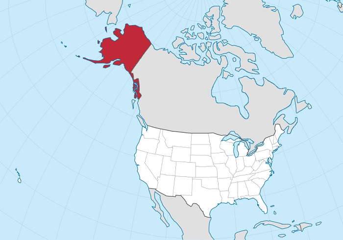
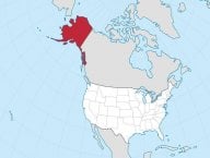
Alaska is the largest state in the United States, covering an area of 1,723,337 square kilometers (665,384 square miles). It is almost twice the size of Texas, the second largest state in the country. Alaska is bordered by the Canadian provinces of British Columbia and the Yukon Territory to the east, the Gulf of Alaska and the Pacific Ocean to the south, and the Bering Sea and the Arctic Ocean to the north. Its vast territory encompasses a diverse range of landscapes, from towering mountain ranges and glaciers to dense forests and tundra. The state's rugged coastline stretches over 6,640 kilometers (4,000 miles), offering stunning vistas of fjords, bays, and countless islands. The imposing Mount McKinley, also known as Denali, stands as the highest peak in North America, adding to Alaska's natural grandeur.
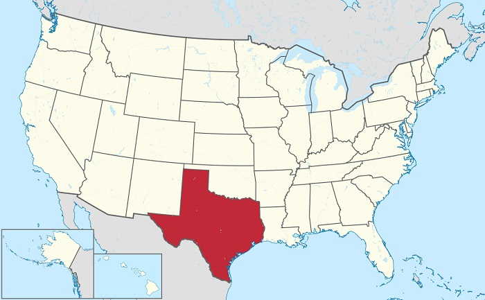
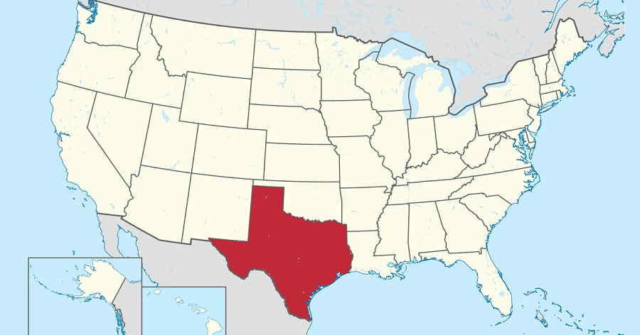
Texas is the second largest state in the United States of America, covering an area of 695,662 square kilometers (268,596 square miles). It is bordered to the north by Oklahoma, to the east by Arkansas and Louisiana, to the west by New Mexico, and to the south by Mexico. he Lone Star State's geography is as varied as it is expansive. To the west, the Chihuahuan Desert dominates the landscape, while central Texas features the famous Hill Country, characterized by rugged terrain and clear rivers. The state's eastern regions include piney woods and rich, fertile farmland. Texas' Gulf Coast, stretching for over 600 miles along the Gulf of Mexico, is home to vibrant cities like Houston and Galveston, as well as vital port facilities. The Rio Grande forms a natural border with Mexico in the southwest, while the Red River separates Texas from Oklahoma in the north.
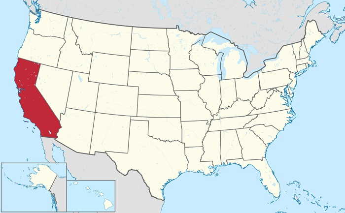
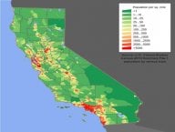
California is the third largest state in the United States in terms of land area. It covers an area of 423,970 square kilometers (163,696 square miles). California is located on the West Coast of the US, bordered by Oregon to the north, Nevada and Arizona to the east, and the Pacific Ocean to the west. The majority of California's terrain is mountainous, with the Sierra Nevada range in the east and the coastal mountains in the west. In between these two mountain ranges lies the Central Valley, the largest agricultural area in the US. The state has a diverse range of climates, with dry deserts in the east and humid coastal regions in the west. California's coastline is over 750 miles long, making it the longest coastline of any US state.
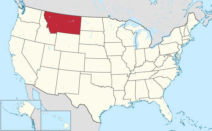
Montana is the fourth largest state in the United States by area. It is located in the Western region of the United States and borders Canada to the north. Montana covers an area of 380,832 square kilometers (147,040 square miles). Known as "Big Sky Country," Montana lives up to its name with its expansive, unspoiled landscapes and endless horizons. The state is defined by its diverse geography, including the towering Rocky Mountains to the west, rolling prairies in the east, and a multitude of lakes, rivers, and dense forests. It's home to Glacier National Park, featuring some of the most pristine wilderness areas in the United States, including the iconic Going-to-the-Sun Road.
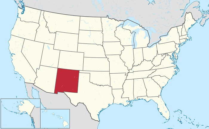
New Mexico is a state located in the southwestern United States. It is the fifth-largest state in the Union, covering an area of 315,194 square kilometers (121,590 square miles). It is bordered to the north by Colorado, to the east by Oklahoma and Texas, to the west by Arizona, and to the south by Mexico. The state has a diverse topography that includes vast deserts, mountains, rolling plains, and high plateaus. New Mexico is divided into 33 counties and contains three distinct geographic regions. The eastern portion of the state consists of the Great Plains and is known for its open expanses and vast grasslands. The central region is made up of the Rocky Mountains, while the western part of the state consists of the Chihuahuan Desert. The highest point in New Mexico is Wheeler Peak at 13,167 feet above sea level, while the lowest point is Red Bluff Reservoir at 2,844 feet. The Rio Grande River serves as the state's longest river, running 1,896 miles from the Colorado border to the Gulf of Mexico.
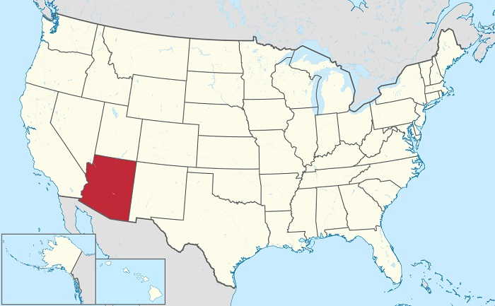
Arizona is a state located in the southwestern region of the United States. It is the sixth largest state in terms of area, with an area of 295,234 square kilometers (113,990 square miles). Arizona is the 48th state to be admitted to the United States, having been admitted on February 14th, 1912. Arizona is bordered by four other states: California, Nevada, Utah and New Mexico. It also has international borders with Mexico along the south and the south-western border. To the north, the state is bordered by the Colorado River and to the east, the state is bordered by the Navajo Nation. Known as the "Grand Canyon State," Arizona boasts a natural beauty and geological diversity that are second to none. The state is renowned for the awe-inspiring Grand Canyon, one of the world's most iconic natural wonders. Carved by the Colorado River over millions of years, the Grand Canyon's towering cliffs and colorful rock formations draw visitors from around the globe. Arizona's geography encompasses more than just the Grand Canyon. The state features deserts, such as the Sonoran Desert, where the saguaro cactus thrives, and mountain ranges like the Superstition Mountains and the San Francisco Peaks.
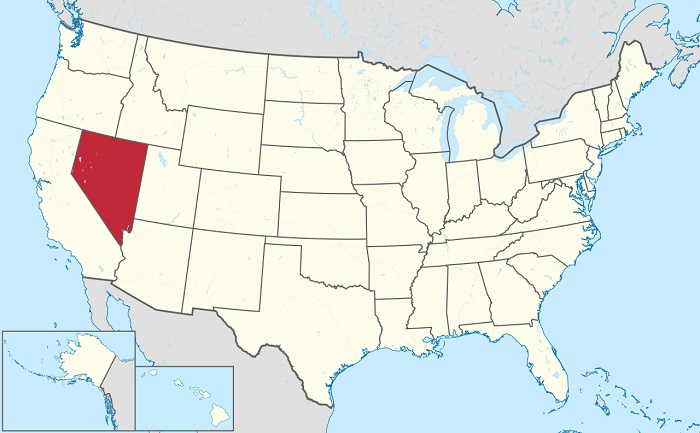
Nevada, located in the western United States, is a state of vast deserts, rugged mountain ranges, and vibrant urban centers. It covers an area of approximately 286,380 square kilometers (110,572 square miles), making it the seventh-largest state in the nation. The state's landscape is dominated by the Great Basin Desert, with the iconic Mojave Desert extending into its southern regions. Nevada's most famous natural landmark is undoubtedly the shimmering, arid playa known as the Black Rock Desert, home to the annual Burning Man festival. In contrast, the Sierra Nevada mountain range borders the western edge of the state, with towering peaks and alpine lakes. The state's highest point, Boundary Peak, reaches 4,006 meters (13,140 feet).
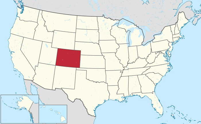
Colorado is the eighth largest state in the United States by land area, covering an area of 269,837 square kilometers (104,094 square miles). It is bordered by Wyoming to the north, Nebraska to the northeast, Kansas to the east, Oklahoma to the southeast, New Mexico to the south, Utah to the west, and Arizona to the southwest. Colorado is divided into 64 counties, with Denver as the state capital. The highest point in Colorado is Mount Elbert, at 14,433 feet above sea level. The state also has a large variety of other mountains, including the Rocky Mountains, the Sangre de Cristo Mountains, the San Juan Mountains, and the Sawatch Range. Colorado is home to many lakes, rivers, and reservoirs, including the Arkansas River, the Colorado River, and Lake Dillon. Colorado has a diverse landscape, with high mountain ranges, deep canyons, and wide plains.
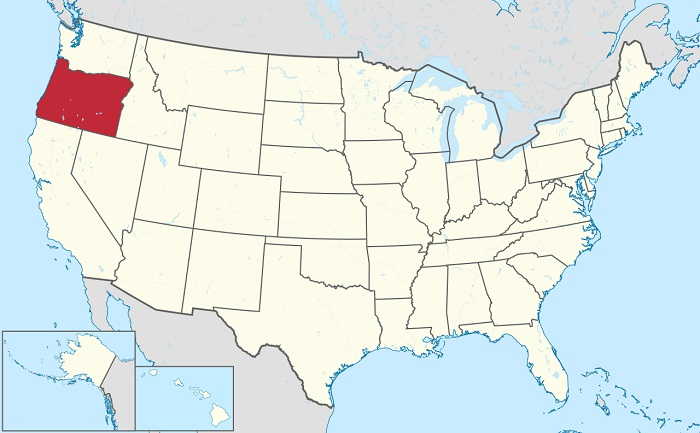
Oregon is located in the Pacific Northwest region of the United States and covers an area of 255,026 square kilometers (98,376 square miles). It is the ninth-largest state in the nation, and is bordered by Washington to the north, Idaho to the east, Nevada and California to the south, and the Pacific Ocean to the west. Oregon has six distinct geographic regions, the Coast Range, the Willamette Valley, the Cascade Range, the Columbia Plateau, the Blue Mountains, and the Klamath Mountains. The Coast Range is a mountain range that runs along the northwestern edge of Oregon and extends from the California border to the Columbia River. It is home to lush forests and is the most accessible part of the state for visitors. The Willamette Valley is a fertile agricultural area located in the western part of the state and is the most populous region in Oregon. The Cascade Range is a volcanic mountain range that runs through the center of the state and is home to Mount Hood, the highest peak in the state. The Columbia Plateau is a large area of flat land located in the northeastern part of Oregon.
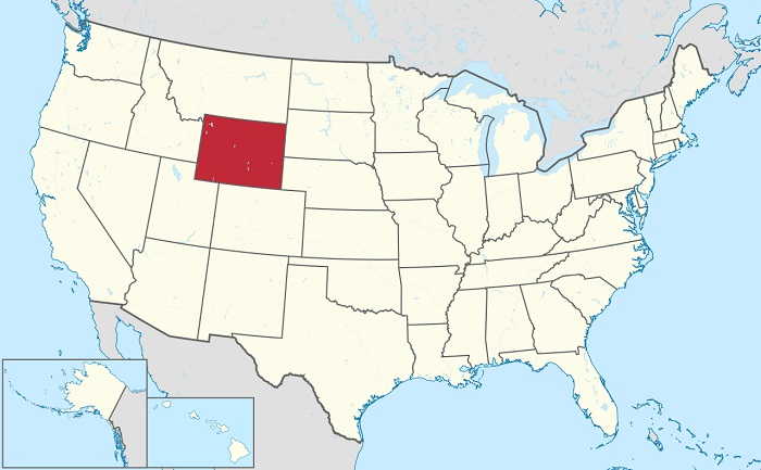
Wyoming is the 10th largest state in the United States in terms of total area, with an area of area of approximately 253,600 square kilometers (97,813 square miles. The geography of the state is diverse, consisting of the Great Plains in the east and the Rocky Mountains in the west. Wyoming is home to some of the most beautiful natural scenery in the entire country, which makes it a popular destination for travelers and outdoor enthusiasts alike. The highest point in the state is Gannett Peak, which stands at 13,809 feet above sea level. The majority of Wyoming is made up of grasslands and shrublands, with areas of forest and mountain ranges along the western border. The state is also home to several large national parks and monuments, including Yellowstone, Grand Teton, and Devils Tower.

_491.jpg)

_362.jpg)