
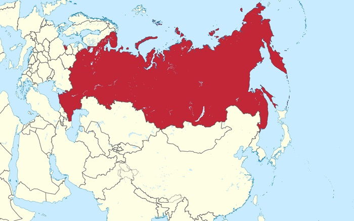
Russia is the world’s largest country in terms of land area, spanning over 17,098,242 square kilometres, making up roughly one-eighth of Earth’s inhabited land area. It is bordered by fourteen countries, including Norway, Finland, Estonia, Latvia, Lithuania, Poland, Belarus, Ukraine, Georgia, Azerbaijan, Kazakhstan, Mongolia, China, and North Korea. Russia is located in both Eastern Europe and Northern Asia, and covers most of the Ural Mountains, the Caucasus Mountains, and the Volga River watershed. Russia has a diverse topography that ranges from frozen tundra in the northern regions to semi-arid steppe in the south and mountains, valleys, and plains in between. The Ural Mountains form a natural border between Europe and Asia, and the Caucasus Mountains separate Russia from the Middle East.
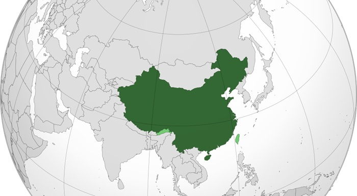
China is the third largest country in the world, with a land area of approximately 9.6 million square kilometers. It is bordered by 14 countries, including Mongolia, Russia, South Korea, North Korea, India, Pakistan, Afghanistan, Kazakhstan, Kyrgyzstan, Tajikistan, Nepal, Bhutan, Myanmar, and Vietnam. China is divided into 23 provinces, 5 autonomous regions, and 4 directly controlled municipalities. This vast territory contains diverse geographical features, from the high plateaus and wide deserts of the northwest to the tropical rainforests and coral reefs of the southeast. China is also home to some of the world's longest rivers, including the Yangtze, Yellow River, and Heilongjiang. In the east, the Bohai and East China Seas provide both economic and recreational opportunities. The Himalayan Mountains, Tian Shan, and Kunlun Mountains dominate the northwest, while the Yungui Plateau covers the southwest.
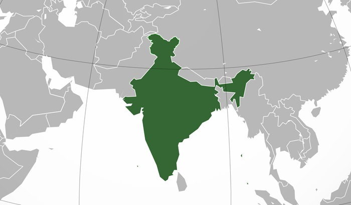
India is the world's seventh-largest country in terms of land area, covering an area of 3.287 million square kilometers. India is a subcontinent, with the Himalayan mountain range to the North and the Indian Ocean to the South. The country is bordered by seven countries, namely Pakistan to the North-West, China, Nepal and Bhutan to the North, Myanmar to the East, and Bangladesh and Sri Lanka to the South-East. India also has an exclusive economic zone in the Indian Ocean, stretching from the Andaman and Nicobar Islands in the east to the Lakshadweep islands in the west. The northern part of India is dominated by the Himalayan mountain range, while the southern part is mostly composed of flat plains and plateaus. India’s coastline stretches over 7500 kms, with the Arabian Sea to the west and the Bay of Bengal to the east.
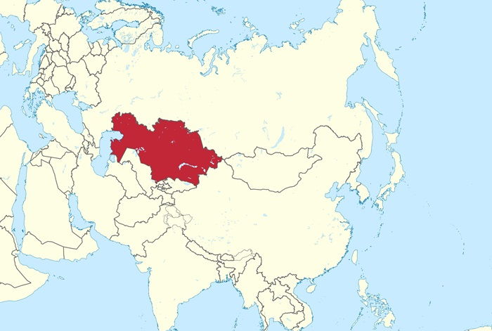
Kazakhstan is the world’s largest landlocked country, with an area of 2,717,300 square kilometers. It is located in the heart of Central Asia, bordered by Russia to the north, China to the east, Kyrgyzstan and Uzbekistan to the south, and the Caspian Sea and the Ural Mountains to the west. Kazakhstan is an expansive and varied country, with a variety of landscapes ranging from the flat, semi-desert steppes of the north to the wooded hills of the southern highlands. The majority of the country is desert, with the famous Kyzyl Kum Desert occupying the northwest and the Betpak Dala Desert stretching across the south. Kazakhstan's mountainous areas are rich in natural resources. The Tian Shan mountains, located in the south, are home to some of the world's largest glaciers. The Altai Mountains and the Tien Shan mountains are also located in this region.
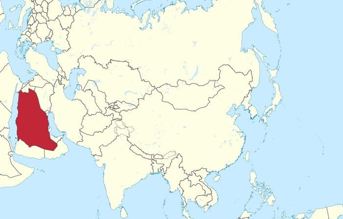
Saudi Arabia is the largest country in the Middle East, with an area of 2,149,690 square kilometers. It is almost four times the size of France, the largest country in Europe. The country is bordered by Jordan, Iraq, Kuwait, the Persian Gulf, Bahrain, Qatar, the United Arab Emirates, Oman, and Yemen. Saudi Arabia is mainly desert and semi-desert, with vast expanses of sand dunes and rocky plains. The Al-Nafud desert is one of the largest in the world, stretching across the north of the country. The Rub al-Khali desert in the south east is one of the driest places on earth. The country is also home to the Red Sea and the Arabian Gulf. The Red Sea is a deep, warm sea that is popular for diving and snorkeling, while the Arabian Gulf is a shallow, heavily populated body of water. Mountains cover about one-third of the country, with the highest peak being Jabal Sawda at 3,133 meters.
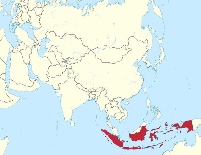
Indonesia is the largest archipelagic nation in the world, with a total land area of 1,904,569 square kilometers. It is the 15th largest country in the world in terms of total area and the 6th largest in Asia. Indonesia is made up of more than 17,500 islands, though only 6,000 of those are inhabited. The country is located between the Indian and Pacific oceans, with the majority of its landmass located between the Celebes Sea and the Java Sea. The two largest islands are Sumatra and Kalimantan, which make up 54% of the country’s total land area. Sumatra is located in the west and is the sixth largest island in the world. Kalimantan is located in the south and is the third largest island. Indonesia also has several smaller islands, including Sulawesi, Java, Bali, and Lombok. Sulawesi is located in the east and is the eleventh largest island in the world. Java is the most populous island in the nation and is home to the capital city, Jakarta.
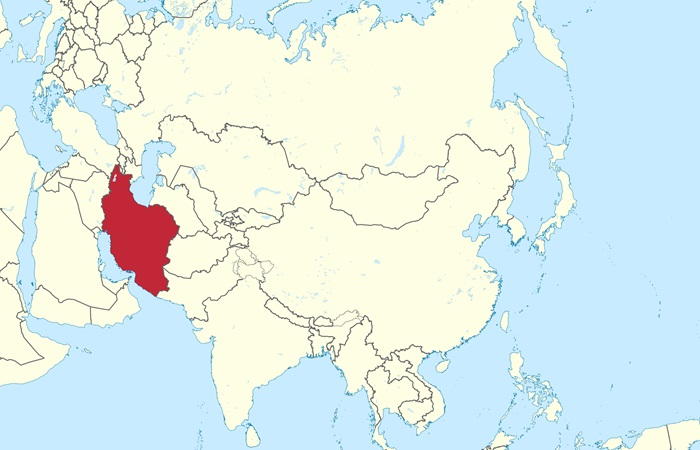
Iran is a large country located in the Middle East. It covers an area of 1,648,195 square kilometers, making it the eighteenth largest country in the world. Iran is bordered by Iraq to the west, Azerbaijan, Armenia, and Turkey to the northwest, Turkmenistan to the northeast, Afghanistan and Pakistan to the east and south, and the Persian Gulf and the Gulf of Oman to the south. The landscape of Iran is mainly made up of rugged mountain ranges, desert terrain and river valleys. The Zagros Mountains form the largest mountain range in the country, running from north to south along the western borders of the country. The Elburz Mountain range, located to the north of the Zagros Mountains, is the second largest mountain range in the country. The central plateau of Iran is largely composed of desert terrain, and is the country’s most sparsely populated region. The highest point in the country is Damavand, which stands at 5,671 meters above sea level.
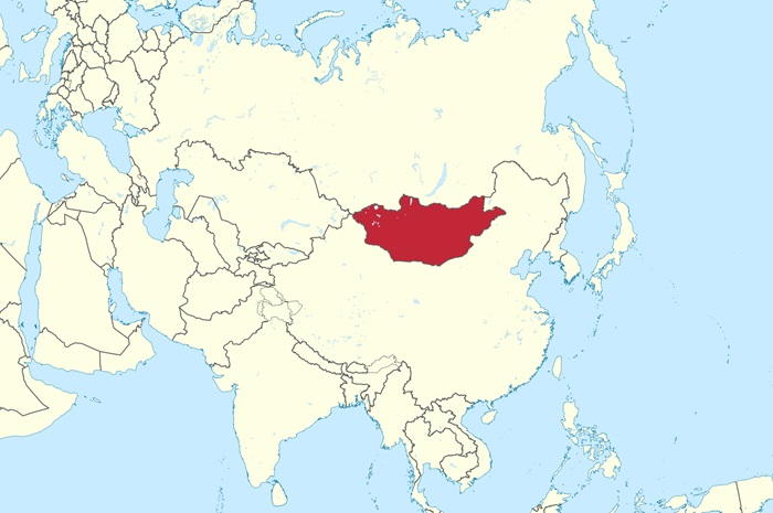
Mongolia is a landlocked country located in Central Asia, bordered by Russia to the north and China to the south. It is the world's 18th-largest country, with an area of 1,564,116 square kilometers. Mongolia is divided into 21 provinces, known as aimags and subdivided into 315 districts. The capital city, Ulaanbaatar, is located in the central region of the country and is the largest city in Mongolia. Mongolia's terrain is diverse and consists mostly of desert, grassland, and mountain ranges. The Gobi Desert, the world's fifth-largest, covers much of the country's south-western regions. The mountainous regions of the Altai, Khangai, and Khentii are located in the north and west, while the steppe grasslands of the east and south are home to many of the country's nomadic herdsmen. The highest peak of the Altai Mountains, Tavan Bogd, stands at 4,374 meters above sea level.
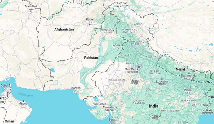
Pakistan is the 33rd-largest country by total area, covering an area of 881,913 square kilometers. Pakistan is bordered by India to the east, Afghanistan to the west, Iran to the southwest, and China to the northeast. The country’s northwestern regions include the Hindu Kush mountain range, which is home to some of the world’s highest peaks and passes. Pakistan has four provinces and two territories, of which the most populous and politically influential is Punjab. It is home to the country’s largest cities and economic hubs, including Lahore, the capital, and Karachi, the country’s most populous city. Pakistan’s landscape is dominated by the Indus River, which flows through the country from north to south and is fed by a number of smaller rivers. The Indus Plain, which makes up the majority of the country’s land area, is home to the majority of the population.
Turkey is the 37th largest country in the world in terms of land area, with a total of 783,562 square kilometers. The country is bordered by eight countries: Bulgaria, Greece, Armenia, Azerbaijan, Iran, Iraq, Syria, and Georgia. Turkey also has an extensive coastline, which includes the Black Sea, the Sea of Marmara, the Aegean Sea, and the Mediterranean Sea. Turkey has a diverse and varied terrain, ranging from high mountains in the east to the low coastal plains in the west. The highest peak in the country is Mount Ararat, which rises to a height of 5,137 meters. Other prominent mountain ranges in the country include the Taurus Mountains and the Pontic Mountains.
_491.jpg)


_362.jpg)